Page 1 :
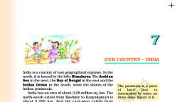
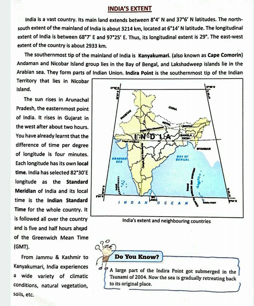
INDIA’S EXTENT, , India is a vast country. Its main land extends between 8°4’ N and 37°6’ N latitudes. The northsouth extent of the mainland of India is about 3214 km, located at 6°14’ N latitude. The longitudinal, extent of India is between 68°7’ E and 97°25’ E. Thus, its longitudinal extent is 29°. The east-west, extent of the country is about 2933 km., , The southernmost tip of the mainland of India is Kanyakumari. (also known as Cape Comorin), Andaman and Nicobar Island group lies in the Bay of Bengal, and Lakshadweep islands lie in the, Arabian sea, They form parts of Indian Union. Indira Point is the southernmost tip of the Indian, Territory that lies in Nicobar, Island,, , , , The sun rises in Arunachal, Pradesh, the easternmost point, of India. It rises in Gujarat in, the west after about two hours., You have already learnt that the, difference of time per degree, of longitude is four minutes., Each longitude has its own local, time. India has selected 82°30'E, longitude as the Standard, Meridian of India and its local, time is the Indian Standard, Time for the whole country. It, Is followed all over the country, and is five and half hours ahead, of the Greenwich Mean Time, (GMT)., , From Jammu & Kashmir to, , , , , , Kanyakumari, India experiences, , 2? A large part of the Indira Point got submerged in the, a wide variety of climatic ‘Tsunami of 2004. Now the sea is gradually retreating back, , Conditions, natural vegetation, to its original place., , Soils, etc,