Page 1 :
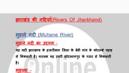
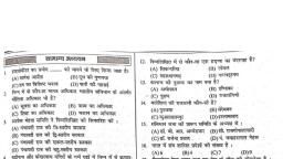
Scanned by CamScanner, 260, झारखंड, सामान्य ज्ञान, पास नहीं रख सकता है।, समय सीमा तक भूस्वामी के द्वारा बेदखल न करने का प्रावधान रखा गया। किसी गरीब काश्तकार को भूमि, पर मलिकान, 9. 1947 से राज्य में आर्थिक विकास, (राज्य का भूगोल, पहाड़, नदी, नदी घाटी परियोजनाएँ,, खान एवं खनिज, परिवहन एवं संचार), 1972 ई. में राज्य सरकार के द्वारा पुनः एक भूमि सुधार अधिनियम लाया गया। इसके तहत् रैयतों को अपनी स ी, पर पूर्ण रैयती अधिकार देने का प्रावधान किया गया। इस अधिनियम में भूमि चकबंदी अनिवार्य रूप से लाग कर से न, अत: आजादी के बाद भारत के विभिन्न राज्यों की भू व्यवस्था को देखने से यह स्पष्ट रूप से दिखता है कि, भूमि का ज्यादातर भाग कुछ ही स्वामी के पास था। जमींदारी व्यवस्था में सामान्य काश्तकारों का पूर्ण शोषण से, अत: राज्य सरकारों के द्वारा अलग-अलग समयों में जमींदारी प्रथा के उन्मूलन की घोषणा, भूमि हदबंदी लागू करना म, और काश्तकारों की बीच मध्यस्थों को खत्म करने का प्रावधान लाना, रैयतों को पूर्ण अधिकार दिया जाना, भूमि चकत, झारखंड : भौगोलिक स्थिति, झारखंड की जलवायु, नदियाँ, भू, झारखंड की, प्रमुख जलप्रपात, झील और बाँध, नदी घाटी परियोजनाएँ, झारखंड की सतही मिट्टी, खान एवं खनिज, परिवहन एवं संचार, प्रमुख, को लागू किए जाने का प्रावधान किया गया।, झारखंड : भौगोलिक स्थिति, झारखंड 24 जिलों से मिलकर बना है। यह भारत का 28वाँ राज्य है। इसकी भौगोलिक स्थिति निम्न प्रकार है-, > झारखंड उत्तरी गोलार्द्ध में 21° 58 से 25° 18' उत्तरी अक्षांश के बीच स्थित है।, > इसका देशांतरीय विस्तार 83° 19' से 87° 57' पूर्व के बीच है।, > इसका क्षेत्रफल 79,714 वर्ग किलोमीटर है।, > इसकी पूर्वी सीमा पर पश्चिम बंगाल स्थित है। इसकी पश्चिमी सीमा पर छत्तीसगढ़ और उत्तर प्रदेश स्थित हैं।, > इसकी उत्तरी सीमा पर बिहार स्थित है।, > इसकी दक्षिणी सीमा पर ओड़िसा स्थित है।, झारखंड की जनसंख्या 2011 की जनगणना के अनुसार 32,988,134 है। 19वीं शताब्दी से पहले झारखंड बंगाल का, हिस्सा था और 1 अप्रैल, 1912 को यह अलग होकर बिहार में आ गया। बिहार में भी इसकी भौगोलिक स्थिति में परिवर्तन, ৪ए। सन् 1936 में बिहार से पृथक हो उड़ीसा राज्य बना और सन् 1948 में इसमें सरायकेला, खरसावाँ को सम्मिलित, कया गया। सन् 1953 में पनर्गठन आयोग ने इसके 5.573 कि.मी. भू-भाग को बंगाल में मिला दिया। इस प्रकार तीन बार, नाजन के बाद बिहार का कुल क्षेत्रफल 1.74,038 वर्ग कि.मी. रह गया। इसमें से 79,714 वर्ग कि.मी. क्षेत्रफल के रूप, में झारखंड राज्य अलग हुआ।
Page 5 :
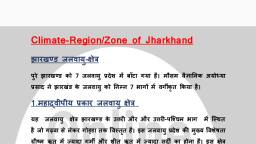
Scanned by CamScanner, झारखंड, सामान्य ज्ञान, 268, झारखंड, सामान्य जञान, 269, उत्तरी एवं उत्तर-पश्चिमी जलवायु केषेत्र, झारखंड में वर्षा की स्थिति-वर्ष 2014, वर्षा की मात्रा (मी.मी.), जिला, जिला, राँची, खूँटी, हजारीबाग, 831.4, वर्षा की मात्रा (मी.मी.), गिरिडीह, 957.6, ৪22.4, वर्षा अपेक्षाकृत कम ही होती है।, बोकारो, 916.8, 903.9, धनवाद, मध्यवर्ती जलवायु क्षेत्र, इस क्षेत्र में वर्षा 50-60 से.मी. होती है। तेज हवाओं का आगमन होने से लू तथा तेज आँधी भी इस क्षेत्र में, कदा चलती रहती है, लेकिन इसका प्रभाव कोई अधिक नहीं होता इसमें हजारीबाग, बोकारो और धनबाद शामिल ३, 730.9, 1046.4, गुमला, सिमडेगा, लोहरदगा, पूर्वी सिंहभूम, | पश्चिमी सिंहभूम, सरायकेला-खरसावाँ, कोडरमा, ৪44.৪, 537.8, रामगढ़, 1141.5, 695.5, चतरा, 717.5, पूर्वी संथाल जलवायु क्षेत्र, इस क्षेत्र में सापेक्षिक आर्द्रता अधिक होती है, क्योंकि यहां औसत वर्षा 60 से.मी. से भी अधिक हो जाती है। राजम, की पहाड़ियां उष्ण पश्चिमी वायु और बंगाल की खाड़ी की आर्द्र वायु के बीच दीवार बनकर खड़ी हो जाती हैं। गर्मियों सें, ये अधिक वर्षा का कारण भी बनती हैं।, 601.4, दुमका, जामताड़ा, |देवघर, गोड्डा, साहेबगंज, पाकुड़, ৪97.9, ৪97.9, 995.0, 1003.0, 942.6, 754.3, पलामू, 474.09, 752.5, सागरीय प्रभाव वाला जलवायु क्षेत्र, इस क्षेत्र में औसत वर्षा 55 सेमी. से 60 से.मी. तक होती है। यहां शीतकाल की अवधि कम होती है। स्वर्णरेखा घाटी, चाईबासा और पंचपरगना के समतल मैदानों में इसका विस्तार होता है। समुद्र का समीपवती होने के कारण यह नार्वेस्टर से, भी प्रभावित क्षेत्र है। इसे झारखंड में सबसे अधिक वर्षा वाला क्षेत्र माना जाता है।, गढ़वा, 476.3, 992.9, लातेहार, ৪06.5, (स्रोत : कृषि विभाग : 2014), उपर्युक्त सारणी से स्पष्ट होता है कि सिमडेगा में वर्षा सबसे अधिक और कोडरमा में सबसे कम होती है। यद्यपि, अয वर्षों में वर्षा की न्यूनता भी रही है, जिससे राज्य में सूखे की स्थिति भी उत्पन्न हुई। सन् 2004-05 में औसत वर्षा, अधिक रही। जलवायु के आधार पर झारखंड में प्राकृतिक वर्षा पर्याप्त होती है, लेकिन प्राकृतिक वनों के कटाव से इनमें, कमी आ रही है, जबकि कुछ क्षेत्रों में अतिवृष्टि भी होती है।, जल संसाधन एक प्राकृतिक वरदान है, जिसके अभाव में जैवमंडल का विकास संभव नही है। झारखंड का कुल जल, संसाधन 28,781 मिलियन घन मीटर अनुमानित है, जिसका 82.7 प्रतिशत (23,789 मिलियन घन मीटर) सतही जल संसाधन, के रूप में है। 17.3 प्रतिशत (4,992 मिलियन घन मीटर) भूमिगत जल के रूप में है। झारखंड के लिए जल संसाधन का, संरक्षण अनिवार्य है, क्योंकि यहां औसत वार्षिक वर्षा 125 से 150 से.मी. के बीच होती है। खनन, औद्योगिकीकरण एवं, शहरीकरण के कारण जंगलों का विनाश तेजी से हुआ है। यह राज्य पहाड़ी सतह का क्षेत्र है। इसी कारण इसमें वर्षा का, जल ठहर नहीं पाता है। अत: भूमिगत जल का भंडार काफी सीमित है। यही कारण है कि नदियां तथा नदी घाटियां राज्य, में जल के मुख्य भंडार और स्रोत का कार्य करती हैं। झारखंड की अधिकतर नदियां मौसमी हैं। अत: वर्षाकाल में यहां, को नदियों में पर्याप्त जल उपलब्ध रहता है। इसके विपरीत ग्रीष्मकाल में दामोदर तथा स्वर्णरेखा को छोड़कर अन्य नदियां, जलविहीन हो जाती हैं या उनमें जल की मात्रा बहुत ही कम पाई जाती है।, दक्षिण-पश्चिमी जलवायु क्षेत्र, पश्चिमी सिंहभूम का दक्षिणी क्षेत्र, जिसमें कोयल व शंख नदी हैं, इस जलवायु के विस्तार क्षेत्र हैं। यहां पहाड़ीक्षे्र, के कारण समुद्री हवाओं का आगमन नहीं हो पाता। इसी कारण यहां शुष्कता रहती है और यह शुष्कता सघन वन क्षेत्रों के, कारण गरमी पैदा करती है। यहां वार्षिक वर्षा औसत रूप में 60 से.मी. होती है।, राँची और हजारीबाग, यहां गर्मियों में तापमान अधिक रहता है और रातें अपेक्षाकृत ठंडी रहती हैं। यहां मानसून का आगमन जून के उत्तरार्ध, में होता है और तापमान में निरंतर कमी होती रहती है। दिसंबर और जनवरी के मध्य ठंडी हवाएँ चलती हैं। 2,000 फोट, की ऊँचाई के कारण गरम पश्चिमी मैदानी हवाएँ इस क्षेत्र में नहीं आ पातीं और यह क्षेत्र लू व आँधी से मुक्त रहता है।, जलवायु क्षेत्र, पाट जलवायु क्षेत्र, वनों की सघनता और क्षेत्र की ऊँचाई अधिक होने से यहां वर्षा अधिक होती है और मौसम सुखद रहता है। इस क्षेत्र, में बगड़ और नेतरहाट आदि क्षेत्र आते हैं।, मौसम अध्ययन के अनुसार ग्रीष्मकालीन तापमान जमशेदपुर में सर्वाधिक और हजारीबाग में सबसे कम रहता है। राज्य, भर में वार्षिक वर्षा का औसत 1,200 मि.मी. है। इससे कई क्षेत्रों में बाढ़ की स्थिति भी पैदा हो जाती है। वर्षा के असमान, वितरण और कहीं-कहीं अधिकता से कृषि को हानि भी पहुँचती है। राज्य में जिलेवार वर्षा का विवरण कृषि निदेशालय,, झारखंड के अनुसार सन् 2014 में ऑका गया, जिसका वर्णन इस प्रकार है-, झारखंड की प्रमुख नदियाँ, राज्य की प्रवाह प्रणाली को दो वर्गों में विभाजित किया जा सकता है-, 1. गंगा में मिलने वाली नदियों की प्रवाह प्रणाली,, 2. दक्षिण में बहने वाली नदियों की प्रवाह प्रणाली।, झारखंड की, प्रमुख, नदियों में दामोदर, उत्तरी कोयल, स्वर्णरेखा, शंख, दक्षिणी कोयल, अजय तथा मोर है। उत्तरी कोयल