Page 1 :
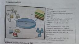
R18 B.Tech. Civil Engg. Syllabus JNTU HYDERABAD, CE711PE: REMOTE SENSING & GIS (PE — Ill), , B.Tech. IV Year | Sem. L T/P/D C, 3 0/0/0 3, Course Objectives:, « Know the concepts of Remote Sensing, its interpreting Techniques and concepts of Digital, images, « know the concept of Geographical Information System (GIS), coordinate system GIS Data, and its types, « Understand the students managing the spatial Data Using GIS., « Understand Implementation of GIS interface for practical usage., , Course Outcomes: After the completion of the course student should be able to, e Describe different concepts and terms used in Remote Sensing and its data, e Understand the Data conversion and Process in different coordinate systems of GIS interface, « Evaluate the accuracy of Data and implementing a GIS, « Understand the applicability of RS and GIS for various applications., , UNIT - 1:, , Concepts of Remote Sensing Basics of remote sensing- elements involved in remote sensing,, electromagnetic spectrum, remote sensing terminology & units, energy resources, energy interactions, with earth surface features & atmosphere, atmospheric effects, satellite orbits, Sensor Resolution, types, of sensors, Remote Sensing Platforms and Sensors, IRS satellites., , Remote Sensing Data Interpretation Visual interpretation techniques, basic elements, converging, evidence, interpretation for terrain evaluation, spectral properties of soil, water and vegetation., Concepts of Digital image processing, image enhancements, qualitative & quantitative analysis and, pattern recognition, classification techniques and accuracy estimation., , , , UNIT Introduction to GIS: Introduction, History of GIS, GIS Components, GIS Applications in Real life, The, Nature of geographic data, Maps, Types of maps, Map scale, Types of scale, Map and Globe, Coordinate systems, Map projections, Map transformation, Geo-referencing,, , UNIT - Il:, , Spatial Database Management System: Introduction: Spatial DBMS, Data storage, Database, structure models, database management system, entity-relationship model, normalization, Data models and data structures: Introduction, GIS Data model, vector data structure, raster data, structure, attribute data, geo-database and metadata,, , UNIT - IV:, Spatial Data input and Editing: Data input methods — keyboard entry, digitization, scanning,, conversion of existing data, remotely sensed data, errors in data input, Data accuracy, Micro and Macro, components of accuracy, sources of error in GIS. Spatial Analysis: Introduction, topology, spatial, analysis, vector data analysis, Network analysis, raster data analysis, Spatial data interpolation, techniques, , UNIT - V: Implementing a GIS and Applications, , Implementing a GIS: Awareness, developing system requirements, evaluation of alternative systems,, decision making using GIS, , 101
Page 2 :
R18 B.Tech. Civil Engg. Syllabus JNTU HYDERABAD, , Applications of GIS: GIS based road network planning, Mineral mapping using GIS, Shortest path, detection using GIS, Hazard Zonation using remote sensing and GIS, GIS for solving multi criteria, problems, GIS for business applications., , TEXT BOOKS:, 1. Remote Sensing and GIS by Basudeb Bhatta, Oxford University Press, 2"¢ Edition, 2011., 2. Introduction to Geographic Information systems by Kang-tsung Chang, McGraw Hill Education, (Indian Edition), 7 Edition, 2015., 3. Fundamentals of Geographic Information systems by Michael N. Demers, 4'" Edition, Wiley, Publishers, 2012., , REFERENCE BOOKS:, , 1. Remote Sensing and Image Interpretation by Thomas M. Lillesand and Ralph W. Kiefer, Wiley, Publishers, 7" Edition, 2015.\, , 2. Geographic Information systems — An Introduction by Tor Bernhardsen, Wiley India Publication,, 3" Edition, 2010., , 3. Advanced Surveying: Total Station, GIS and Remote Sensing by Satheesh Gopi, R., SathiKumar, N. Madhu, Pearson Education, 1% Edition, 2007., , 4. Textbook of Remote Sensing and Geographical Information systems by M. Anji Reddy., , 102

